

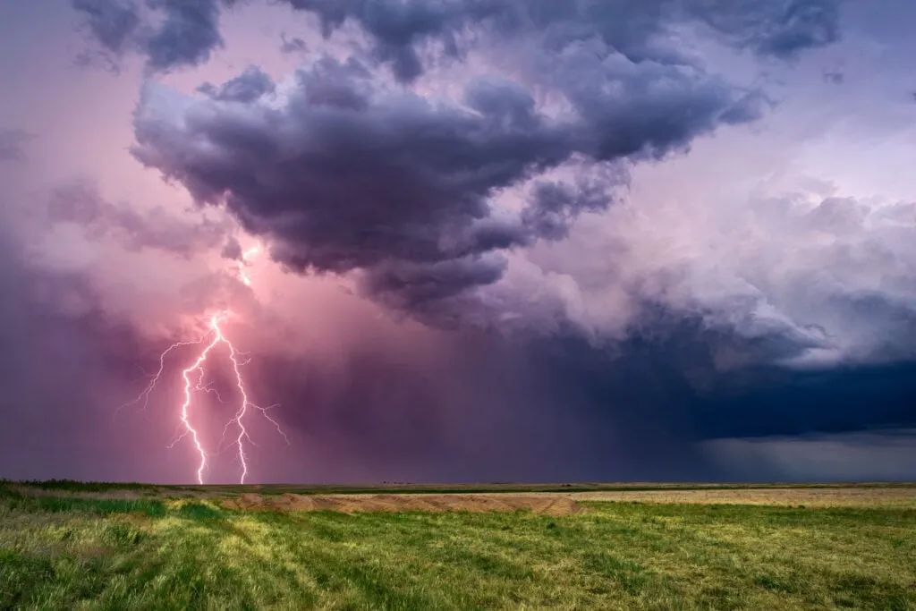
A 2027 storm chasing tour may introduce guests to several forms of dramatic weather, but no chase day follows a guaranteed pattern. One afternoon may produce a sculpted supercell over open farmland, while another may bring frequent lightning, rotating cloud bases or rain shafts stretching across the horizon.
Tornadoes are often the best-known goal of storm chasing, yet they represent only one part of the experience. Understanding the differences between tornadoes, supercells and lightning helps guests appreciate more of what may develop during a professionally guided chase.
What Is a Supercell?
A supercell is an organized thunderstorm containing a persistent rotating updraft. This internal rotation allows the storm to remain active for several hours and can support large hail, damaging winds, frequent lightning and tornadoes.
From a suitable viewing position, a supercell may display a broad storm base, a tall updraft tower and a clearly defined precipitation area. Some storms develop layered or sculpted structures that photographers informally describe as mothership supercells.
The complete shape is easier to observe when the storm remains isolated and the surrounding landscape offers a long, unobstructed horizon.
Guests may notice:
-
A rotating or lowered cloud base
-
Layered bands around the updraft
-
A rain-free area beneath part of the storm
-
Rain or hail shafts beside the main structure
-
An anvil spreading away from the storm top
-
Lightning around or ahead of the precipitation core
Not every visible feature indicates that a tornado is forming. The guides and forecast team continue monitoring the storm as its structure and movement change.
When Does a Tornado Occur?
A tornado is a violently rotating column of air extending from a thunderstorm to the ground. It may become visible through a condensation funnel, swirling dust or debris near the surface.
Many significant tornadoes develop from supercells, but only a minority of supercells produce tornadoes. NOAA notes that scientists still have unanswered questions about why one rotating storm becomes tornadic while another nearby storm does not.
This uncertainty is why no responsible operator can guarantee a tornado sighting. Even during a promising severe-weather window, the atmosphere determines whether the necessary storm-scale processes develop.
A chase without a tornado can still offer:
-
A visually impressive rotating supercell
-
Dramatic cloud movement and changing light
-
Lightning over open countryside
-
Hail or rain shafts visible from a responsible distance
-
Rural landscapes beneath a developing storm
-
A clearer understanding of professional forecasting decisions
Guests who remain interested in the complete weather environment are more likely to value each chase day.
Why Lightning Requires Constant Attention
Lightning can occur before heavy rain reaches an observation point and may strike well away from the main storm. The National Weather Service warns that thunder indicates a high-risk lightning area and that strikes can extend from a supercell’s anvil at a considerable distance from the parent storm.
Guests should never move away from the group or remain outside after guides instruct everyone to return to the vehicle. A hard-topped vehicle can provide protection when substantial shelter is unavailable, but the team’s directions must take priority.
Lightning can also create striking photography opportunities. Wide landscape compositions may show flashes beyond a field, highway or distant town. However, no image is worth remaining exposed when the team decides conditions are unsafe.
How the Team Selects the Day’s Target
Each chase day begins with a review of current weather conditions. Forecast experts compare possible target areas and decide where organized storms are most likely to develop.
The group may travel several hours before storms form. Once activity begins, guides and drivers may reposition to maintain visibility, avoid heavy precipitation and preserve practical road options.
A typical chase may include:
-
A morning weather forecast briefing
-
Travel towards the chosen target
-
Waiting for clouds to develop
-
Observation of growing storm structure
-
Repositioning as movement or visibility changes
-
Travel to the hotel selected for that night
The plan remains flexible because the strongest storm may not form exactly where or when the morning forecast suggested.
Tour 6 and the Central Plains
Tour 6 is particularly relevant to guests interested in supercells, tornado potential and Plains photography. The package begins with arrival in Wichita on June 12, 2027, followed by six chase days from June 13 through June 18.
Its official description highlights Central Plains scenery, more isolated mothership-style storms and routes extending from traditional chasing areas near Oklahoma into Nebraska and beyond. The package includes five hotel nights during the active chase, transportation, fuel, forecast experts, guides and drivers, weather briefings and a guaranteed window seat.
Conclusion
A 2027 chase may reveal tornadoes, rotating supercells, lightning or a combination of memorable weather features. A tornado is never guaranteed, and even an organized supercell may remain non-tornadic.
The wider experience includes observing storm structure, following changing forecasts and traveling through open Plains landscapes while a professional team manages positioning and road decisions.
By understanding what each weather feature represents and following guide instructions, guests can appreciate the full chase rather than judging the journey by one possible tornado sighting.